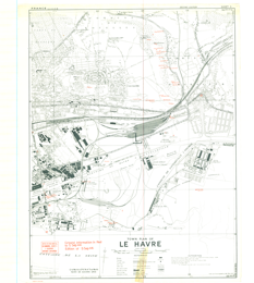
Le Havre, France (East). 1:10,000. Map Sheet 3, 2nd Edition, Town Plan, Defence Overprint, 5 September 1944Coordinate system: 3857 Abstract:This is a 1:10,000 scale map (defence overprint) of the region of Le Havre, France (East). It is the second edition of this map, published on September 5, 1944 by the Geographical Section, General Staff (GSGS) of the War Office of Great Britain. This overprint utilizes the Nord de Guerre Zone Grid. Production information for the base map is 5/43/GSGS. Production information for the overprint is 1500/9/44/3RCE/5153. |
Additional Documentation
-
Metadata Information
Language: eng; CANLast Update: 2018-06-05Metadata Contact:Scholars Portal, Ontario Council of University Libraries Toronto Ontario, CanadaContact Instructions:datagis@scholarsportal.infoMetadata Contact:GeoSpatial Centre, University of Waterloo Libraries Waterloo Ontario, CanadaMetadata Standard:North American Profile of ISO19115:2003 - Geographic Information -
Citation Information
SeriesName:
Great Britain. War Office. General Staff. Geographical Section. London , Great BritainThemes or Categories of the Resource: intelligenceMilitaryKeywords:roads, routes, railways, chemins de fer, canals, canaux, ditches, fossés, dikes, digues, soil information, informations sur le sol, buildings, bâtiments, areas of damage, zones de dégâts, bridges, ponts, tunnels, tunnels, cliffs, falaises, walls, murs, quarries, carrières, defences, défenses, airfields, aérodromes, mines, mines, barracks, casernes, trenches, tranchées, shelters, abris, hospitals, hôpitaux, contour lines, lignes de contour, Le Havre, Commune de Rouelles, Commune d'HarfleurSecond World War, Deuxième Guerre Mondiale, Topographic maps, Carte topographiquePlace Keywords:Continent > Europe > Western Europe >FrancePurpose:Historic military maps are an excellent resource for the study of the Second World War, and can also provide an excellent view of the changes that have occurred in the cultural and physical landscape. As this map has been georeferenced, it can be used in a GIS as a source or background layer in conjunction with other GIS data.Dataset Language:Status: completedUpdate Frequency: notPlannedSpatial Representation Type: gridExtentWest Longitude: 0.125East Longitude: 0.22North Latitude: 49.525South Latitude: 49.4635
-
Reference System Information
-
Data Quality Information
Scope Level: datasetOriginal paper maps were produced by various governments and mapping agencies during the Second World War, as part of the preparations for and immediately after D-Day (Operation Neptune). Paper maps were originally held by the Department of Defence, and were distributed by the Directorate of History and Heritage, Government of Canada, in the 1990s. Maps in this collection were acquired by the Laurier Military History Archive (LMH).
Process step:Original paper maps were scanned and georeferenced at the University of Waterloo. -
Distribution Information
Distributor:Scholars Portal, Ontario Council of University Libraries Toronto Ontario, Canada -
Related Links