Source Protection Area GeneralizedCoordinate system: 4269 - "NAD83" Abstract:This data set is a polygon coverage that can be used to identify the location of a Source Protection Area Generalized, a smoothed version of the technical Source Protection Planning Boundary (SPPB) that is owned by the Ministry of Environment (MOE). A Source Protection Area (SPA) is an area of land and water governed by a Source Protection Authority which defines the watershed area within which the terms of reference, assessment reports and source protection plans must be developed. A Source Protection Authority is the agency, person or body responsible for developing a Source Protection Plan. 'Generally, the source protection authority follows the same structure as the conservation authority boards, which are made up of members appointed by municipal councils.' Supplementary look-up table descriptions are available in the data description document, which is available for download from the additional documentation section. |
Additional Documentation
-
Metadata Information
Language: eng; CANLast Update: 2014-03-24Other Maintenance Requirements:67c0f01f-7a75-4e20-aa5e-ba24a4f4df9cMetadata Contact:Scholars Portal, Ontario Council of University Libraries Toronto Ontario, CanadaContact Instructions:gis@scholarsportal.infoMetadata Standard:North American Profile of ISO19115:2003 - Geographic Information -
Citation Information
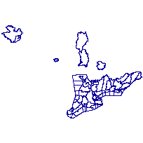
Ontario Ministry of Natural Resources Peterborough Ontario, CanadaThemes or Categories of the Resource: utilitiesCommunicationKeywords:PLANNING, DEVELOPMENT, MUNICIPAL PLANNING, WATER MANAGEMENT, WATER, WATER ANAYLSIS, MUNICIPALITIES, WATER RESOURCES, BOUNDARY, WATERSHEDS, WATER RESOURCES INFORMATION PROGRAM, SOURCE WATER PROTECTION, HYDROLOGY, CONSERVATION, SOURCE PROTECTION AREA, SOURCE PROTECTION AUTHORITY, WATER CONSERVATIONPLANNING, DEVELOPMENT, WATER MANAGEMENT, WATER, WATER ANALYSIS, WATER RESOURCES, Watersheds, HYDROLOGY, CONSERVATIONPlanning, Planification, Development, Développement, Municipalities, Municipalité, Water, Eau, Water management, Gestion de l'eau, Boundaries, Frontière, Watersheds, Bassin hydrologique, Water conservation, Conservation de l'eau, Hydrology, Hydrologie, Conservation, ConservationPlace Keywords:Continent > North America > Canada > OntarioPurpose:This boundary is used in the management of watershed-based source protection plans, and provides the best science-based definition available where possible. Polygons are based on primary, secondary, tertiary and quaternary watershed boundaries with possible modifications by Source Protection Authorities and Municipalities where better terrain modeling data and expert local knowledge exists. A Source Protection Area (SPA) may be made up of multiple individual polygons each with its own landform, such as island, Watershed, Lake/River. The SPAGEN data class is available to the public for general use and cartographic applications. This cartographic version of the product maintains the resolution of the original SPPB data set, however the boundaries have been smoothed to create a more visually appealing product.Dataset Language:Status: completedUpdate Frequency: asNeededSpatial Representation Type: vectorProcessing Environment:ESRI Arc GIS 9.2 Shape File.; Shapefile in SHP/DBF formatExtentWest Longitude: -90.841681East Longitude: -74.320104North Latitude: 49.308090South Latitude: 41.676551
Supplemental Information: -
Spatial Representation - Vector
Geometric Objects:Object Type: compositeObject Count: 118 -
Reference System Information
-
Data Quality Information
Scope Level: dataset
Conservation Ontario, Conservation Authorities: Conservation Authority Admin Area: Delineation provided by individual Conservation Authorities. Boundaries submitted by individual CAs, various scales, various projections and datums.Water Resources Information Program: Tertiary Watersheds: Water Resources Information Program Watersheds. Tertiary watersheds ArcGIS 8.3 coverageTertiary watershed divisions are 144 sub-divisions of the secondary watershed divisions. Tertiary divisions range in size from 700 square kilometres to 31,000 square kilometres. These polygon boundaries are available in hard copy from Environment Canada or as digital files from Ontario Hydro. For more information, see Watersheds of Ontario: Digital Representation of Primary to Quaternary Watershed Division for Ontario; L.J. Onisto, Ontario Hydro, 1993).WRIP - A Guide To The Provincial Watershed Project - Second Edition - Bates et al. 2002Water Resources Information Program: Quaternary Watershed: Water Resources Information Program Quaternary Watersheds. Created from Provincial DEM Version 2 information. Boundaries have been improved based on newer information. This was an interim raster product, which has since been incorporated in a Quaternary Watershed Version 2 product. Release Date: May/June 2008. Data collected on 01/06/2007. Quaternary watersheds are fourth level drainage areas. They are subdivisions of tertiary watersheds. WRIP - A Guide To The Provincial Watershed Project - Second Edition.pdfConservation Ontario and select Source Protection Authorities: Local Knowledge and Expertise: Source Protection Authority boundary interpretations based on the best available data sources. Data collected on 01/01/2002. High resolution DTM / break lines obtained from various data sources (orthophotography, LIDAR etc) typically captured at 1 : 2 000 / 1 :4 000 scales. Revisions based on these sources were conducted and provided by the Source Protection Authority. -
Distribution Information
Distributor:Ontario Geospatial Data Exchange, Ministry of Natural Resources (OMNR) Peterborough Ontario, Canada -
Related Links