Lot Fabric ImprovedCoordinate system: 4269 - "NAD83" Abstract:Revision Note: Please note that this dataset has been revised and is available from the Land Information Ontario (LIO) Warehouse. A Lot is a surveyed area that is a subdivision within a geographic township. In many townships, lots lose area to road allowances. Lots are land identifying a portion of a Concession within a Geographic Township. The townships, concessions and lots comprise the original township fabric of the Province. This layer is part of what was known as the OMNR Fundamental Dataset. |
Additional Documentation
-
Metadata Information
Language: eng; CANLast Update: 2013-02-20Other Maintenance Requirements:32831597-97ed-497e-8c45-d6d24fd59f11Metadata Contact:Scholars Portal, Ontario Council of University Libraries Toronto Ontario, CanadaContact Instructions:gis@scholarsportal.infoMetadata Standard:North American Profile of ISO19115:2003 - Geographic Information -
Citation Information
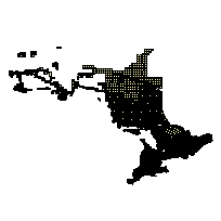
Ontario Ministry of Natural Resources Peterborough Ontario, CanadaThemes or Categories of the Resource: boundariesKeywords:LAND MANAGEMENT, MUNICIPAL PLANNING, MAPPING, LANDS, LAND USE PLANNING, PLANNING, DEVELOPMENT, ADMINISTRATION, TOWNSHIP FABRIC, ONTARIO BASIC MAPPING, OBM, DTDB, DIGITAL TOPOGRAPHIC DATA BASE, BASE MAPPING, TOWNSHIPS, FUNDAMENTALPLANNINGBoundaries, Frontière, Urban planning, Urbanisme, Planning, PlanificationPlace Keywords:Continent > North America > Canada > OntarioPurpose:The geographic township fabric (which includes lots) is a fundamental land subdivision of the Province, which is shown as it was originally surveyed, unless it has been annulled upon the instruction of the Surveyor General.Dataset Language:Status: onGoingUpdate Frequency: annuallySpatial Representation Type: vectorExtentWest Longitude: -95.153511East Longitude: -74.344032North Latitude: 51.540023South Latitude: 41.909384
Supplemental Information: -
Spatial Representation - Vector
Geometric Objects:Object Type: compositeObject Count: 293210 -
Reference System Information
-
Data Quality Information
Scope Level: dataset
NRVIS Township Fabric - As part of the Ontario Parcel build contract, existing NRVIS geographic township fabric was confirmed (to MNR materials) prior to its use in the Ontario Parcel build. Should the build Contractor determine that the position of MNR's NRVIS geographic township fabric was unacceptable, the Contractor was to improve the geographic township fabric based on the materials provided by MNR. If the contractor did not have any better information that would improve the township fabric, then they were instructed to leave the fabric as it already exists in NRVIS.The objective of the Township Fabric Improvement project was to obtain as much survey information on certain subdivided townships from the best possible source in order to enhance the spatial representation of the fabric in a digital database. Through the acquisition of Ontario Land Surveyors' records and opinions, GIO obtained survey information that may better indicate where some lot and township corners should be positioned. Township Improvement includes materials and survey information provided by local surveyors. This information was incorporated into the Ontario Parcel build. Please note: Not all townships were improved, depending upon available survey information and whether there was interest from the surveyor to do the work. The improved fabric from both the Township Improvement/Ontario Parcel projects will be inserted into a new township fabric data model that will reside in both NRVIS and the LIO warehouse. Data collected from 01/01/2000 to 30/06/2005Township Realignment Project - For 230 townships in southern Ontario where Teranet's POLARIS and BIM mapping exist, the NRVIS township fabric was realigned with the fabric and parcels from POLARIS and BIM mapping. The POLARIS and BIM parcel fabric data was used to build the NRVIS fabric, because it is deemed to be more accurate than the present NRVIS township fabric. -
Distribution Information
Distributor:Ontario Geospatial Data Exchange, Ministry of Natural Resources (OMNR) Peterborough Ontario, Canada