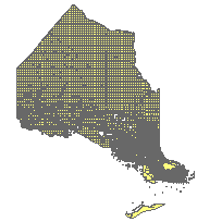
Crown Land - MNR Unpatented LandCoordinate system: 4269 - "NAD83" Abstract:This data set is a polygon coverage that can be used to identify the location of lands that have never been patented by the Crown or have been depatented or forfeited. This layer is part of what was known as the OMNR Non-Fundamental Dataset. |
Additional Documentation
-
Metadata Information
Language: eng; CANLast Update: 2014-04-29Other Maintenance Requirements:444dbd2a-36b7-41d4-93ae-7283ed0e0309Metadata Contact:Scholars Portal, Ontario Council of University Libraries Toronto Ontario, CanadaContact Instructions:gis@scholarsportal.infoMetadata Standard:North American Profile of ISO19115:2003 - Geographic Information -
Citation Information
Ontario Ministry of Natural Resources Peterborough Ontario, CanadaThemes or Categories of the Resource: boundariesKeywords:LAND USE, LAND USE PLANNING, LAND MANAGEMENT, CROWN, CROWN LAND, LAND CLASSIFICATION, LAND TENURE, PUBLIC LAND, NON-FUNDAMENTALLAND USE, LAND USE PLANNING, CROWN, PUBLIC LAND, LAND CLASSIFICATION, LAND TENURELand management, Gestion des terres, Crown lands, Terres de la CouronnePlace Keywords:Continent > North America > Canada > OntarioPurpose:The data set is to be used for planning and illustrative purposes. It is not intended to be used to replace a legal survey.Dataset Language:Status: onGoingUpdate Frequency: asNeededSpatial Representation Type: vectorProcessing Environment:NRVISExtentWest Longitude: -95.153740East Longitude: -74.377711North Latitude: 56.859364South Latitude: 41.676556
Supplemental Information: -
Spatial Representation - Vector
Geometric Objects:Object Type: compositeObject Count: 58437 -
Reference System Information
-
Data Quality Information
Scope Level: dataset
Ontario Parks: Protected Areas: Parks and Conservation Reserves used to verify Crown Land locations. Combination of Provincial Parks and Conservation Reserves.Ontario Ministry of Natural Resources (MNR): District land ownership data: Used to identify lands under MNR management. Digital land ownership data provided by the District GSO which may or may not be stored in corporate databases.Ontario Ministry of Natural Resources (MNR): Land Use Permit System (LUPS): Used to match or verify files. Permits can only be issued on Crown land. Contains land use permits issued by MNR Districts.Ontario Ministry of Natural Resources (MNR): G-plans: Used to verify data. Hard copy mylars historically used to track land tenure.Ontario Ministry of Natural Resources (MNR): Land Files. Used to verify forfeitures. Hard copy files containing correspondence, forfeitures notices, etc. -
Distribution Information
Distributor:Ontario Geospatial Data Exchange, Ministry of Natural Resources (OMNR) Peterborough Ontario, Canada