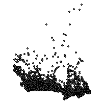
Populated Placenames (PPN)Coordinate system: 4326 - "WGS 84" Abstract:This point file represents populated places across Canada. Each point contains attribute information that includes, but is not limited to: the place name, coordinates, classification and measure of attribute precision. Note: In 2012, there was a datum change from NAD83 to WGS84. |
Additional Documentation
- CanMap RouteLogistics User Manual v2014.2
- CanMap RouteLogistics User Manual v2013.3
- CanMap RouteLogistics User Manual v2012.3
- CanMap RouteLogistics User Manual v2011.3
- CanMap RouteLogistics User Manual v2010.3
- CanMap RouteLogistics User Manual v2009.4
- CanMap RouteLogistics User Manual v2008.3
- CanMap RouteLogistics User Manual v2007.3
- CanMap RouteLogistics User Manual v2006.3
- CanMap RouteLogistics User Manual v2005.3
- CanMap RouteLogistics User Manual v2004 8.2
- CanMap RouteLogistics User Manual v2003 7.2
- CanMap Streetfiles User Manual v2002 6.2
- CanMap Streetfiles User Manual v2001 5.1
-
Metadata Information
Language: eng; CANLast Update: 2015-06-11Other Maintenance Requirements:This metadata was automatically generated from the FGDC Content Standards for Digital Geospatial Metadatastandard version FGDC-STD-001-1998.Metadata Contact:Scholars Portal, Ontario Council of University Libraries Toronto Ontario, CanadaContact Instructions:gis@scholarsportal.infoMetadata Standard:ISO 19115-2 -
Citation Information
SeriesName: CanMap RouteLogistics
DMTI Spatial Inc. Markham Ontario, CanadaThemes or Categories of the Resource: locationKeywords:Places, Place Points, City, Town, Village, Community, Canada, Point dataURBAN AREAS, RURAL AREAS, COMMUNITIESToponymy, Place names, Cities, Urban areas, Towns, Communauté urbaine, ToponymiePlace Keywords:Continent > North America > CanadaPurpose:To provide support for macro-level geocoding and cartographic applications.Dataset Language:Status: completedUpdate Frequency: asNeededSpatial Representation Type: vectorProcessing Environment:Native Dataset Environment: Microsoft Windows 2000 Version 5.2 (Build 3790) Service Pack 2; ESRI ArcCatalog 8.3.0.800ExtentWest Longitude: -141.000000East Longitude: -52.652631North Latitude: 82.516305South Latitude: 41.750000
Supplemental Information:DMTI Spatial Inc Markham Ontario, Canada -
Spatial Representation - Vector
Geometric Objects:Object Type: pointObject Count: 27841 -
Reference System Information
-
Data Quality Information
Scope Level: dataset -
Distribution Information
Distributor:DMTI Spatial Inc. Markham Ontario, Canada