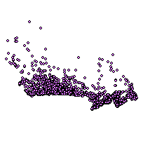
Education (EDU)Coordinate system: 4326 - "WGS 84" Abstract:The Education layer contains Elementary Schools, High Schools (secondary schools), Universities, Colleges and Cégeps. Note: In 2012, there was a datum change from NAD83 to WGS84. |
Additional Documentation
- CanMap RouteLogistics User Manual v2014.2
- CanMap RouteLogistics User Manual v2013.3
- CanMap RouteLogistics User Manual v2012.3
- CanMap RouteLogistics User Manual v2011.3
- CanMap RouteLogistics User Manual v2010.3
- CanMap RouteLogistics User Manual v2009.4
- CanMap RouteLogistics User Manual v2008.3
- CanMap RouteLogistics User Manual v2007.3
- CanMap RouteLogistics User Manual v2006.3
- CanMap RouteLogistics User Manual v2005.3
- CanMap RouteLogistics User Manual v2004 8.2
- CanMap RouteLogistics User Manual v2003 7.2
- CanMap Streetfiles User Manual v2002 6.2
-
Metadata Information
Language: eng; CANLast Update: 2015-06-11Other Maintenance Requirements:This metadata was automatically generated from the FGDC Content Standards for Digital Geospatial Metadata standard version FGDC-STD-001-1998.Metadata Contact:Scholars Portal, Ontario Council of University Libraries Toronto Ontario, CanadaContact Instructions:gis@scholarsportal.infoMetadata Standard:ISO 19115-2 -
Citation Information
SeriesName: CanMap RouteLogistics
DMTI Spatial Inc. Markham Ontario, CanadaThemes or Categories of the Resource: societyKeywords:School, education, secondary, elementary, university, collegeEDUCATION, HIGHER EDUCATION, UNIVERSITY, LEARNINGEducation, School boards, Schools, Universities, Colleges, CEGEPs, Secondary schools, Éducation / Enseignement, Commission scolaire, Université, CollègePlace Keywords:Continent > North America > CanadaPurpose:To create a dataset of Canadian educational facilities. Can be used for cartographic display or statistical applications.Dataset Language:Status: completedUpdate Frequency: asNeededSpatial Representation Type: vectorProcessing Environment:Native Dataset Environment: Microsoft Windows 2000 Version 5.2 (Build 3790) Service Pack 2; ESRI ArcCatalog 8.3.0.800ExtentWest Longitude: -140.875303East Longitude: -52.688227North Latitude: 71.985123South Latitude: 41.808404
Supplemental Information:DMTI Spatial Inc Markham Ontario, Canada -
Spatial Representation - Vector
Geometric Objects:Object Type: pointObject Count: 18595 -
Reference System Information
-
Data Quality Information
Scope Level: dataset
Process step:Dataset copied. -
Distribution Information
Distributor:DMTI Spatial Inc. Markham Ontario, Canada